The Flood Wall
Morgan City Floodwall & Scenic Atchafalaya River Views
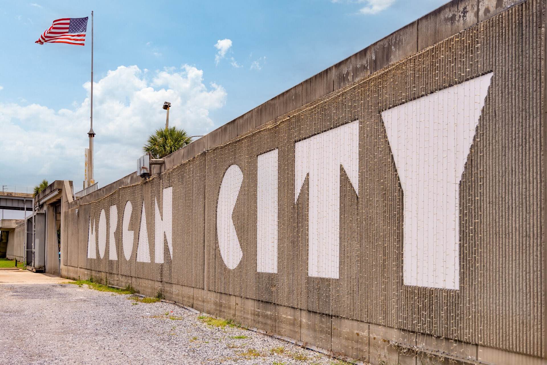
The Morgan City Floodwall protects the city from flooding and is part of the federal MR&T Project. Visitors can walk to the top of the wall for a scenic view of the Atchafalaya River, and a nearby monument displays markers from historic floods.
The Morgan City Floodwall system was designed by the U.S. Army Corps of Engineers to provide increased flood protection for the city. Phase I of the floodwall runs along Front Street from the Southern Pacific Railroad bridge to Brashear Avenue. This section stands 18 feet high and provides protection up to +23 feet above mean sea level (msl). Construction began on May 3, 1983, and was completed on August 16, 1985 by Hobbs Construction and Development of Panama City, Florida, at a cost of $4.1 million.
Protecting the south side of Morgan City is the Tiger Island Floodwall, which extends along Young’s Road from near the Bayou Boeuf Lock to the Southern Pacific Railroad bridge. This floodwall spans more than two miles (11,250 feet), stands 17 feet high, and provides protection to +22 feet msl. Construction began on October 30, 1981, and was completed on December 31, 1984, by Shappert Engineering Company of Belvidere, Illinois, with a final contract cost of $11.6 million.
Phase II of the Morgan City Floodwall connects to Phase I at Brashear Avenue and extends nearly one mile (5,000 feet) to Levee Road. This section is 16 feet high and offers protection up to +24 feet msl. Construction began on October 18, 1983, under a $10.5 million contract awarded to SCE, Inc., of Birmingham, Alabama, and was completed in March 1987.
All four floodwalls in the Morgan City area are constructed of steel sheet piling driven to an average depth of 70 feet below ground, with the exposed portions capped in concrete. Floodwall gates are normally left open to allow vehicular and pedestrian traffic and are closed when flooding threatens the area. The Morgan City and Berwick floodwalls also feature a distinctive “fractured fin” architectural finish, giving the walls a corrugated appearance and incorporating decorative motifs such as boats, ducks, gulls, and cypress trees to reflect the surrounding environment.
Prior to construction of the current floodwall system, flood protection for Morgan City relied on a wall built in the mid-1940s, which provided protection to approximately +13 feet msl. The modern floodwalls increased protection levels by roughly 10 feet, significantly improving flood resilience for the area.
The Morgan City–Berwick floodwalls are part of the Mississippi River and Tributaries (MR&T) Project, a comprehensive federal flood control system authorized in 1928 to protect the Mississippi River Valley from Cairo, Illinois, to the Gulf of Mexico. Under this system, floodwaters entering Louisiana are directed to the Gulf either through the Mississippi River channel or via the Atchafalaya Basin Floodway.
The MR&T Project is designed to safely convey flood flows of up to 3 million cubic feet per second (cfs). Approximately half of this flow travels through the Mississippi River and the Bonnet Carré Spillway, while the remaining 1.5 million cfs is carried to the Gulf through the Atchafalaya Basin Floodway. This floodway is bordered by 449 miles of levees and floodwalls, including the four floodwalls that protect the Morgan City area.
Visitors to the Morgan City Floodwall can also walk to the top of the wall, offering a unique vantage point to view the Atchafalaya River and the surrounding area. From this elevated perspective, you can see the river’s flow, nearby levees, and the city’s flood protection infrastructure, providing both a scenic outlook and a firsthand appreciation of the engineering that safeguards Morgan City.
Visitors are encouraged to stop by the floodwall monument located near the floodgate at Freret Street and Front Street, where water level markers from four major floods and photo plaques documenting five historic floods dating back to 1912 are on display.